Features 지리산 3D
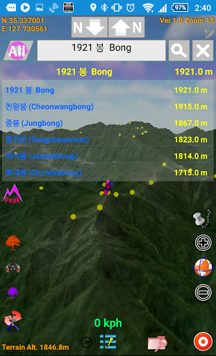
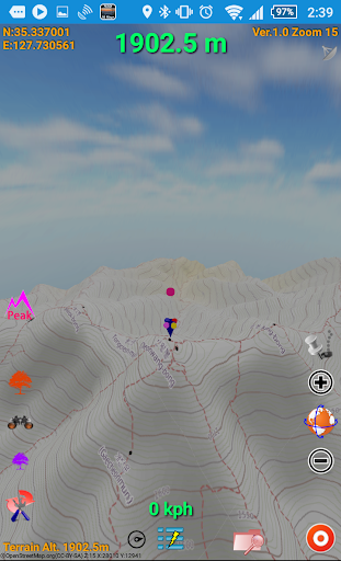
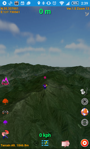
It shows the topography of Jirisan with a resolution of up to 30m×30m,Various Map Types are basically saved offline, so you can use Offline Map immediately after installation.Even if an additional download is performed, it is downloaded only once and used as an offline map.It has various peak location search functions,Tracks can be saved within the Jirisan area, and after saving, the tracks can be viewed in 3D.This app always knows and uses the current location even when running in the foreground as well as in the background.
Offline Mode
Use the app without an internet connection. Your data syncs when you're back online.
Lightning Fast
Experience blazing fast performance with our optimized Android application.
See the 지리산 3D in Action
Get the App Today
Available for Android 8.0 and above